Plant Health with Multispectral Drones: NDVI, NDRE and Flying It Right
Before the Plant Turns Yellow
When a plant meets disease or water stress, visible yellowing (chlorosis) comes last. Before that, the cell structure breaks down, and the change first shows up in the red-edge and near-infrared (NIR) bands. That is the value of a multispectral camera: it measures the bands the eye cannot see.
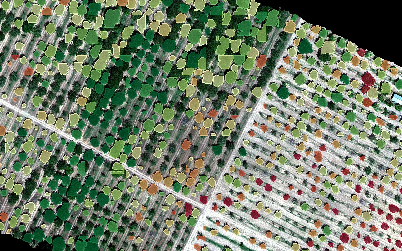
In the PlantFarm Scan project we compute nine indices from these bands. This post collects what each one is for and what to watch during the flight so the measurements can be trusted.
The Indices
| Index | Formula | Bands needed | What it tells you |
|---|---|---|---|
| NDVI | (NIR − R) / (NIR + R) | R, NIR | Overall green biomass and vigour |
| NDRE | (NIR − Re) / (NIR + Re) | Re, NIR | Chlorophyll in dense canopy; separates where NDVI saturates |
| GNDVI | (NIR − G) / (NIR + G) | G, NIR | More sensitive to chlorophyll content than NDVI |
| GCI | NIR / G − 1 | G, NIR | Green chlorophyll index |
| RCI | NIR / Re − 1 | Re, NIR | Red-edge chlorophyll index; needs a true red-edge band |
| VARI | (G − R) / (G + R − B) | R, G, B | Approximate greenness with an RGB camera only |
| TGI | G − 0.39·R − 0.61·B | R, G, B | Chlorophyll approximation from RGB |
| ExG | (2G − R − B) / (R + G + B) | R, G, B | Separating vegetation from soil |
| GLI | (2G − R − B) / (2G + R + B) | R, G, B | Green leaf index from RGB |
Rule of thumb: in a dense, healthy walnut canopy NDVI saturates quickly (every tree looks 0.85–0.90). NDRE is more useful for seeing differences between trees.
Is an RGB Camera Enough?
Partly. An RGB-only orthophoto has no real NIR band, so NDVI and NDRE cannot be computed. VARI, TGI, ExG and GLI can; they are useful for separating vegetation from soil and for a rough greenness map, but not for early stress detection.
When exporting from software such as Pix4D, choose Reflectance Map. If you choose "RGB Orthophoto", the file looks fine in colour but the NIR information is gone. PlantFarm Scan detects the bands automatically from file metadata and statistics; if it guesses wrong, the user can fix the band mapping by hand.
Flight Plan
An index is only as reliable as the image. These are the flight parameters we use for walnut orchards:
| Parameter | Recommendation | Why |
|---|---|---|
| Time of day | Local noon ±2 hours (10:00–14:00) | Shortest shadows under trees |
| Sky | Fully clear or fully overcast | Patchy cloud shadows push NDVI artificially low |
| Wind | Below 15–20 km/h | Moving leaves break band-to-band alignment |
| Sun angle | Above 30–40° | Low angles mean long shadows |
| Altitude | 50–70 m | 2–4 cm/pixel resolution |
| Overlap | 80% front, 75–80% side | Walnut crowns are dome-shaped; do not go below 70% |
| Speed | 5–7 m/s | Avoids motion blur |
Calibration
Radiometric calibration is what gives the image numeric meaning:
- Calibration panel: photograph the panel from about 1 m right before and right after the flight, without casting the sensor's shadow on it.
- Downwelling light sensor: the light sensor on top of the drone must have a clear view, with no propeller shadow.
Comparing the NDVI of two uncalibrated flights is like comparing two scales with different units. Per-tree trend tracking only makes sense with calibrated flights.
One Flight Is Not Enough
A tree with NDVI 0.72 does not tell you much by itself; that may be normal for its species, age and season. The real information is in change: a tree that has dropped for three flights, or one that behaves differently from its neighbours. That is why PlantFarm Scan gives every tree a persistent ID and adds a point to its index series on every flight. We also compare each tree with the ground around it, which separates an orchard-wide drop from a problem specific to one tree.
Conclusion
With the right camera, the right flight and calibration, a multispectral drone is a strong early-warning tool. Combined with a model that finds trees one by one, it takes you from orchard scale to tree scale. For details, see our Industrial AI solution.